Flood lessons, forgotten lanes, fireworks and Ribblesdale photos

wharfe

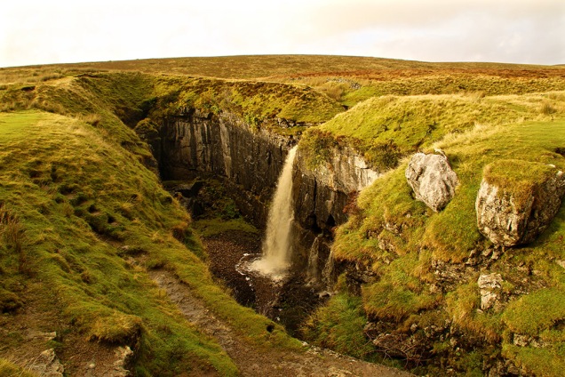
The former newsman in me said I ought to go find some dramatic flood shots last week, but then I thought that would only be adding to the misery of the situation. Flooded fields, gushing rivers and waterfalls are often witnessed here in Ribblesdale but further down the valleys, as all that water looks for a way back to the sea, many homes, businesses and lives can be ruined as a consequence.

In Nature, every action causes a reaction. When us humans mess with Nature, be it through greed or naivety, we generally cause mayhem somewhere down the line. Hopefully, a lesson is being learned about what causes flooding besides awful weather: the value of flood plains and why they shouldn’t be built upon; the erroneous river-banking to increase landownership; the cutting down of trees which absorb water; the bad management of moorland; the slashing of funds needed for proper river dredging, etc. Our obsession with cars doesn’t help – we build roads without adequate consideration for natural water flow, create enormous car parks; remove gardens so cars can be parked… the list goes on.

In 2012 I wrote a Diary piece in Dalesman following some more dreadful flooding in Hebden Bridge – here’s an extract:
“ … many residents are partly blaming the management of the nearby Walshaw Moor where it is claimed that excessive burning of the blanket bog has been taking place. The estate owners, [headed by Boundary Mills businessman Richard Bannister] have also created new tracks through the 6,000ha estate which has increased the flow of water down the hillside. Sphagnum moss, Nature’s ‘sponge’ which slows the water coming off the moor, is rapidly disappearing as the estate owners try to create a habitat for red grouse which are then shot.
“The management of this estate has caused Natural England to raise serious concerns in recent years. However, in March, without a clear explanation, Natural England reached an agreement with the landowners over the estate management and dropped legal proceedings, including a prosecution on 43 grounds of alleged damage.
“Residents have set up a Ban the Burn campaign and are asking for support. They say: “We are aware that this is not just a local issue and it is not just about flooding. Sphagnum mosses are the main peat forming species providing vital carbon sequestration and carbon storage, but damaged UK peatlands currently release almost 3.7 million tonnes of CO2, equivalent per year of more than all the households in Edinburgh, Cardiff and Leeds combined.”

Three years on the battle to see sense continues, and the unfortunate residents of Calderdale are still suffering. This isn’t just me having a go at rich folk again. We could all do more… by protesting against stupidity and greed and offering practical help: simple things like helping rid your local beck of rubbish, keeping drains clear of leaves and other debris, making sure your garden has grass, trees and plants and not just covered with impervious Tarmac or decking. Rant over.

dentstation

bridges

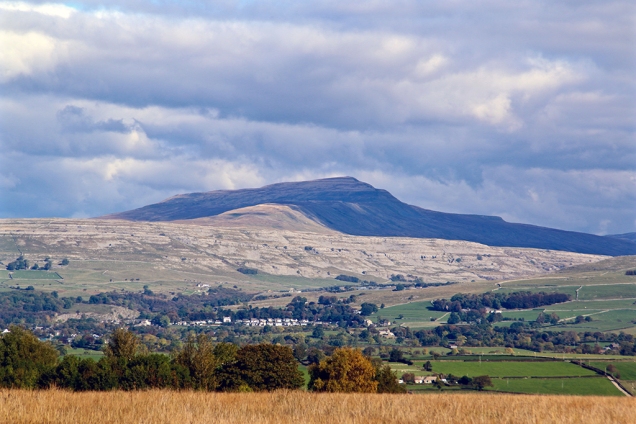
The promise of blue sky tempted me out on Tuesday. Mist hung around the tops of the Three Peaks (Penyghent below) as I drove through Ribblesdale to Dentdale. The simple old road bridge over the beck is dwarfed by the viaduct on the Settle-Carlisle line at Cowgill. I turned up the steep, Third-World-road between Dent and Garsdale railway stations where the views in all directions are wonderful. I couldn’t imagine making a living on these wild, boggy moors – it seems some have tried and failed. Returning home via Appersett, which had been cut off by flooding the previous day, a patch of blue sky briefly lit up Stags Fell as though nothing untoward had happened over recent times.

oldfarm

pygcloud

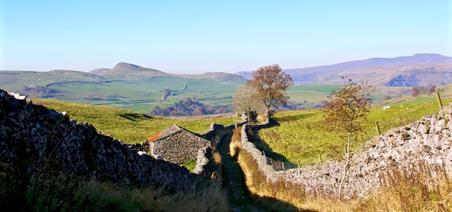
A couple of centuries ago, the main road from Settle to the west went through Giggleswick, Lawkland and on towards Austwick and Clapham. These places are now all bypassed by bigger, faster roads. The old lanes and off-shoots provide a pleasant drive or walk in lovely countryside completely missed by the majority of motorists to this part of the Dales. Those who travelled the ancient route by horse and cart centuries ago would have probably stood mouth agape at the sight of the mainly Elizabethan Lawkland Hall (a private residence with a fascinating history). Visit www.hha.org.uk/Property/568/Lawkland-Hall

lawkland

My route was only just clear of water problems as I carried on through Austwick (pictured), and on to the hamlet of Wharfe (first photo in blog). The road back to Ribblesdale via Helwith Bridge was impassable the previous day because of flooding.

sheepaustwick

The following day I ascended – on foot – the steep slope from my house to Winskill Stones. It’s only a mile, but after eating and drinking excessively since my last trip up that hill I needed several ‘photo halts’. The light in the north-west was weird, probably something to do with incoming storm, while above and behind me was a bright blue sky.

unusuallight

A classic Winskill shot beckoned as that gallant tree, seemingly sprouting impossibly from the limestone, and Lower Farm standing out like a beacon set the scene.

classicwinskill

Descending back down the side of Stainforth Scar looking towards Settle I saw that the mysterious vanishing tarn was back again. Geological features, ancient field patterns, the rolling Ribble and distant Langcliffe Mill show the development of this area.

rivertarn

Impressive as they were, I felt a tad miffed watching London’s extravagant fireworks on New Year’s Eve. Knocking on £2m spent on 11 minutes, during which time half of London’s population stood with camera phones pointing towards the sky, taking blurry pictures that will end up looking like the remnants of a three-year-old’s birthday party spread. £2m can be raised for the capital’s hedonistic event but ask for brass for London’s homeless or the North’s flood victims and people look the other way. Call me a party-pooper if you want, but I’m sure we used to enjoy NYE just as much before all this excess.
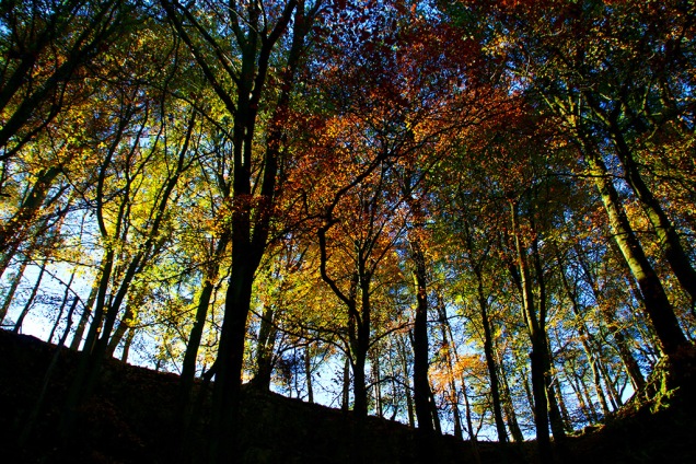
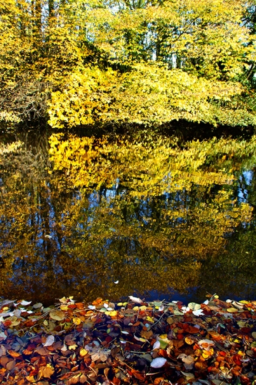
Ribblesdale photos

For my final photo round-up of the year I’ve chosen from pictures taken between September and November inclusive. I’ve not included December as most can be viewed in recent posts. Have a happy new year and thanks for dropping by.

Bronte shame, sailor’s trousers, embarrassing falls and yet more flooding


farpyg

The weather gods granted me a day out on Wednesday – as my mum used to say, there was ‘enough blue sky to knit a pair of sailor’s trousers’ — so I enjoyed a drive and short walk along and beside the Stainforth to Halton road in the morning, then a trip to Malham from Langcliffe in the afternoon. Penyghent looked resplendent – seen above from Dale Head – while at the Giant’s Grave there was still plenty of water around to creatrockfalle a splash or two. Here the water can take several different directions, filling huge potholes before eventually finding a way down Penyghent Gill and into Littondale.

In the upright photo showing the moors above Halton Gill in the distance, is evidence of a recent rockfall probably caused by the storms. The tree hangs on precariously.

4wayfall

Farms along Henside Road from Cowside to Arncliffe via Malham Tarn are often cut off during winter. I recall Bill Mitchell writing a piece for Dalesman about a family stranded at Capon Hall Farm for several weeks during the bad weather of (I think) 1962. Here’s one of the farms, with Malham Tarn visible in the background. There was a light sprinkling of snow/slush around the higher moors on Christmas Eve but nothing to bother these hardy farmers too much … yet.

capon

I like seeing the fields above Malham, and the limestone of the cove, in the early evening sun when most of the tourists are making their way home. The animals graze peacefully and the whole scene takes on a more pastoral feel.

malham

Embarrassing Falls

The heavy rain has reintroduced many waterfalls which are usually only observed when the underground channels are full. The historic view of water tumbling over Malham Cove last week is a prime example, but there have been many other reappearances too throughout the Yorkshire Dales. This one on the Horton side of Selside doesn’t often teem over the top. It’s a fine little fall which according to the Ordnance Survey doesn’t have a name. Ended-on-my-arse-here Falls would be appropriate, for me at least. Muddied and briefly embarrassed, hoping that no one witnessed my mishap, I walked towards High Birkwith and back along the Pennine Bridleway.

embarrassing falls

On returning home this little chap was waiting for me. He posed for one picture on a neighbour’s bench, then flew off. I haven’t seen him since – perhaps his mission is to say hello to everyone in the dale over the Christmas period.

robin

Even more rain towards the end of the week meant extended time on the computer or watching some mind-numbingly tedious Christmas TV programmes, usually involving ‘celebrities’ – most of whom I’ve never heard of. Can we look forward to a series titled ‘Celebrities on Benefits’. Only a joke, before people write in. It’s no laughing matter being unemployed and anyway, whingeing about TV seems churlish considering what happened yesterday. The floods in the north have caused devastation and severely disrupted the lives of many thousands of people. I had to curtail my journey down the Aire Valley yesterday – I had never seen it so badly flooded – and I was lucky to get back up to Ribblesdale before the roads were closed or impassable. My heartfelt sympathy to everyone affected. Sorry, Mr Cameron, you’re going to have make yet another journey oop t’north for a photo-shoot to show the nation what a caring PM you are.

Bronte shame

Bronte panopticon

A few miles from Ribblesdale is the once-deserted hamlet of Wycoller which contains a partly ruined hall, thought to be the setting for Ferndean Manor – the home of Rochester in the Charlotte Bronte novel, Jane Eyre. The place underwent a bit of a revival a while back but is now under threat again, along with the Wycoller Country Park (pictured above at the Panopticon) and the Bronte Way footpath. All are under the care of Lancashire County Council, but it is now planning to completely close down the management, maintenance and ranger service. If this happens visitors may no longer be able to see the great aisled barn or use the countryside activity centre. The visitor toilets will close and the privately run cafe and shop are unlikely to survive. Wycoller hamlet is one of the area’s prettiest destinations, attracting thousands of Bronte fans, and is served by dozens of volunteers. It is managed by a countryside ranger with a modest budget, so any cost savings from closing it down will be negligible. I first became interested in the area’s literary connections and fascinating countryside some forty or so years ago, and believe it would be a shame if this key part of the Bronte heritage was lost forever. If you agree sign this petition or contact the council https://t.co/dbEffg09af

Ribblesdale images

The second instalment of my ‘Year in Ribblesdale’ picture gallery shows snaps taken between May and August inclusive. The choice was difficult as there were some lovely days during spring and summer. September to December photos follow next week.

Floods, pixies, rainbows and poor development


floods top

I was annoyed that I couldn’t get to Malham to capture the rare sight of water tumbling over the Cove last weekend. The road from home to Malham was blocked, and with floods all around Settle I didn’t want to risk a longer journey. Settle bypass was also closed and the alternative route through town and up Buckhaw Brow was under water in parts. I did walk up to Giggleswick Scar and snapped the water lying in the Ribble valley floodplain. The former Giggleswick Tarn (top pic) also made a rare appearance. In 1863 a chap called Joseph Taylor came across a medieval dug-out canoe while carrying out drainage works on the site of the former Giggleswick Tarn — just thought I’d tell you.

floods lake ribble

floods waterfallAlso making a comeback was a stretch of water beneath Stainforth Scar near Langcliffe, and a waterfall down the scar — not quite as spectacular as the one at Malham Cove but a rarity all the same.

floods new tarn

While I was scuttling about around the old tip beneath Stainforth Scar, trying to find a decent spot to take the waterfall photo, I spotted this tiny fungus growing on the tip of a fence post. Nature never ceases to amaze me. I swear I noticed a couple of tiny dancing pixies but I put that down to the previous night’s red wine.

floods pixies

You will have noticed that I’m slightly better at photographing things that stay still for long periods. For three days this week I visited the millpond at Langcliffe Locks trying to capture a spectacular kingfisher which I first glimpsed on Tuesday. There was another flash of blue, inches above the water, on Thursday but I was too slow to get a picture. Friday I loitered around again but didn’t see it. I was distracted briefly by a squirrel scampering across a wall but once more I was too slow focusing on the speedy little beggar. Later it popped up on fence just after I put the camera away. It was definitely smirking.

floods bridge

While in Stainforth I nipped down to the Foss which was in an excited mood; a thunderous, boiling cauldron in fact, as the Ribble swept through like a tidal wave first beneath the ancient arches of the packhorse bridge and then over the deep, rocky precipice.

floods boss

The river was much calmer on Friday after its exertions of the previous few days. I often wonder why the Ribble rushes so much in these parts — you’d think it would saunter through Yorkshire and push on as quickly as possible through Lancashire.

floods calm

Yesterday we were hit by snow and yet more rain. You’ll be starting to think this blog is just about the weather, but it really has dominated life recently in the dale and beyond. At least some rainbows around Ribblesdale helped briefly brighten the place up. The Christmas lights in Settle are also cheering — let’s hope the weather doesn’t totally ruin the year’s best week for local traders.

floods rainbow

Floods

Like most people — at least those living north of the M62 — my thoughts have been with those affected by the storm and floods in the North West. Sometimes there’s not a lot we can do about taming Nature and we just have to cope with it — as the good folk of Cumbria seem to be doing: help if you can… http://www.cumbriafoundation.org

Understanding flood plains and leaving them well alone is, however, something people CAN control. Yet a recent report by Greenpeace states that almost half of those areas fast-tracked for new housing development by the government are on floodplains. On top of this, the number of staff in the floods and coastal erosion risk management section of the Environment Agency has been reduced dramatically in the past three years, along with the agency’s funding. Trying to solve one problem by creating another is very poor management of the country’s affairs.

Feedback

It seems that I am one of the few people in the world without a smart phone. I’m really old fashioned and still use a computer (one of those things that sit on a desk with a big screen – you remember them, don’t you?). It appears that the flipbook of Ingleton I produced for last week’s blog doesn’t work too well for those who prefer squinting at a tiny screen and swishing it around in circles to avoid reflections. So I’ve produced a more ‘mobile-friendly’ version here…

For anyone who has more money than sense and owns one of those watch-screen-thingies then… tough, get out more and go see Ingleton for yourself (smiley do-da wotsit here).

A wet week, but who cares – London’s okay

ribbleheadTrain tannoy: “Ladies and gentlemen… as we cross the famous Ribblehead Viaduct, on your left you will see absolutely nothing; on your right, there is a very wet bloke with a camera.” Walking round Ribblehead when the rain is traveling sideways, you quickly learn which items of your gear warrant an all-weather tag. I hope Santa is well prepared, because there’s going to be a lengthy ‘I want’ list from me. My ‘fully waterproof’ bag ended up with a puddle in it – at least I can confirm the bottom doesn’t leak. (By Friday many trains along the Settle-Carlisle route were cancelled due to flooding. At one point in the Eden Valley the river was over a mile wide.)

clapbridge

A brief respite from the rain on Friday tempted me out to do a little long-exposure photography – not everyone’s cup of tea, I know, but a useful skill to learn properly. There was probably a bit too much water, flowing too quickly, down Clapham Falls to get a satisfactory ‘silky’ effect. But while in the village I couldn’t stop myself taking the stock photo across old Brokken Bridge. This scene always makes a good in autumn or winter photo.

shroud

This tiny waterfall in the former quarry at Ribblehead appears quite angelic and there’s even a shrouded figure merging. I did the short ‘green’ walk around the Ingleborough National Nature Reserve (which includes the quarry). Although the tops of Ingleborough and Whernside were shrouded in cloud, Penyghent could still be seen beyond Gauber and Colt Park.

pyggauber

I was so bored during the poor weather this week that I actually started to sort out a cupboard where books and other bits had been tossed when I first moved into the house. I soon stopped though when I came across a 1920s guide book to Ingleton. It’s a fascinating window into life ninety years ago. In those days tourists flocked to this part of the world mainly by rail and charabanc – but increasingly by road, as reflected by the adverts and editorial. There were once two railway stations  serving the village – one, run by Midland Railway company, was where the village community centre now is in the car park, and the other was at the Thornton side about a mile away, operated by London & North Western. At one time, to change trains from one operator to the other, passengers could pay a penny fare to cross the viaduct between the two stations and enjoy the view.
You can view the whole leaflet by clicking on the link below. (Press esc to return to this page if viewing on computer.)

If you’re on a mobile click here to view the Ingleton Guide

NB I have tried to check copyright details on this publication. The publishers, Ingleton Advertisers Association, no longer exist. If anyone knows of a copyright holder please let me know and I will gladly acknowledge them.

langflood

Yesterday afternoon I took an exhilarating short walk with Desmond (the storm, not a new friend) around Langcliffe. I thought, once you’re wet it doesn’t really matter does it? The route of my regular jaunt by the Ribble is usually alongside the river bank… there appeared to be this small puddle in the way so I gave it a miss.

Having my regular walk disrupted is, of course, a minor inconvenience compared with the problems being caused by Storm Desmond. Some of the flooding in the region and further north is catastrophic for many people and will affect their lives for many months, if not years. The government is willing to spend millions every night on bombing Iraq and Syria in the belief this will protect us against terrorists, but it has actually held back money for properly protecting some towns and villages in the North West from flooding. But then again, it wasn’t London under attack from Mother Nature was it, just those uncouth tribes of the North.

wifehole

Feedback

Talking of uncouth, I’d like to say to an old friend that his suggestion for the origin of the name Braithwaite Wife Hole, is totally wrong and uncalled-for. My thanks to those others who tried to decently explain the sinkhole’s name mentioned in last week’s blog. In what must be one of the longest book titles going (‘A descriptive tour and guide to the lakes, caves, mountains and other natural curiosities in Cumberland, Westmorland, Lancashire and a part of the West Riding of Yorkshire’) John Housman, writing in 1800, calls it Barefoot-wives’ Hole. This name is also found in West’s Guide to the Lakes, 1778/1821 and on old maps dating as far back as 1760. A map of 1890, however, shows the name has been changed to Braithwaite Wife Shake Hole. Just like with many place-names and surnames, early scribes often misunderstood local terms and accents when it came to writing down terms that had previously been passed down through generations of verbal history, so perhaps the original name will remain a mystery – unless you know differently.

Signs of the past, dodgy wives and the Elf King

sunsetpyg

After last week’s regular Sunday stroll by the Ribble under Stainforth Scar I stayed out a bit later than normal to watch the sun go down. Golden light settled briefly on the Scar, while Penyghent looked cooler in the distance with snow still lying in the shade. The late sun shining through the trees above Langcliffe stopped me in my tracks. No filters or Photoshop shenanigans on these shots, just the ‘sunset’ setting on my camera.
treegatesun

pjsignpostAround 40 years ago I posed for this photo at Ribblehead (taken by my friend Graham Hobson). The signpost was replaced with a bland version many years ago – probably due to idiots climbing up the old one. The photo serves to remind me just how long I’ve been visiting this enigmatic area. I’m always finding something different or interesting here – long may it continue. I was there again on Wednesday, taking a boggy trek around the Limestone Walk on Ingleborough Nature Reserve in Chapel-le-Dale. There were still some icy patches along the path where the sun hadn’t reached, and flecks of snow were still visible on Whernside.

ingleuprightAlong this route you can hear water rushing into and through the limestone caverns beneath your feet. There’s a great network of caves and pot holes around here, and the path, going clockwise, passes Great Douk Cave then later, joining the main path up to Ingleborough, goes by the amazing sinkhole of Braithwaite Wife Hole – partly pictured below. It’s around 80ft deep and knocking on 200ft wide. I’d be interested to know how it got the name – there are a few sink holes named after wives in the Dales. Legend has it that the ladies were chucked down the giant pits after some misdemeanour. But if that were the case you’d think there’d be even more of them named after men.


wifehole

oldfarmIt’s sad to see old farm buildings in a dilapidated state – like this one at Southerscales in Chapel-le-Dale. But I suppose it is all part of the evolution of the Dales. Less than a mile away on one of the limestone ridges between Ingleborough and Ribblehead are the remains of an ancient settlement, dating back thousands of years. In this part of the Dales humans have come and gone since prehistoric times and evidence of ancient walls can be found all around…
oldwall

Making a living on this boggy land has always been extremely difficult. Shaded by Ingleborough, Simon Fell and Park Fell, there is little direct sunlight during winter. Hardy farmers still try to eke out a living here…

farmer

I took some fine photos of Chapel-le-Dale along the route, which I’ve already posted on Facebook and Twitter this week, showing Twisleton Scar, Whernside and Ribblehead Viaduct. Here’s a different one, looking down on the small settlement around the Chapel Inn.

chapdale

As Black Friday turned into Grey Saturday there were few photographic bargains to be had in the dales for me, but one of my neighbours, Mark Corner, emailed me this photo taken on Giggleswick Scar. Myths and legends surround these ‘fairy circles’, and here Mark’s lovely dog Oscar looks like a worthy king of the elves.

corner

Water way to go, cats, dogs and a dodgy chopper

ribweir

The value of natural flood plains in the Dales was highlighted this week as they calmed the flow of rivers swollen by the excessive rain. New lakes were created here in Ribblesdale and throughout the region, saving communities further down the valleys from severe flooding (apart from where housing and industrial development has been erroneously allowed). As well as poor planning decisions there are other problems along riverbanks which have been created by humans. One is the way some landowners have banked up river edges to preserve or increase grazing land. In times of flood these act as barriers, and instead of letting rivers spread naturally, they speed up flow causing problems elsewhere. Weirs, built in many cases to help power old mills and create mill ponds, can also have an adverse effect. I watched the weirs and Langcliffe and Settle this week and saw first hand what they do when the rivers are high and fast-flowing. These artificial barriers raise water levels behind then cause a huge hydraulic jump afterwards. This causes great turbulence and danger in the worst conditions as witnessed in my picture. I’m all for capturing a river’s power to create electricity through well-placed turbines but I wonder if weirs are really necessary today? Also, in low water weirs are a barrier to fish migration and promote the growth of algae.
dogturd

There’s a popular walk from Settle along Watery Lane, but it proved a bit too watery last Sunday. I did manage this photo, however, where it seems the local allotment holders or perhaps fellow walkers are fed up with coming across doggie-do. I’m not sure whether the luminous paint looks worse than the dog mess but it certainly gets the message across.
inglequarry

There was still plenty of water at the top of the dale on Monday as I took a stroll in the Ribblehead region and around Ingleborough Nature Reserve. Signs of industry don’t have to be depressing and can create some interesting views.

kilningle

whernquarry

While I was below  Ingleborough I came across the Coastguard Sikorsky S-92 helicopter which had got into difficulties the previous day. The Cave Rescue Organisation, based in Clapham, requested help from the Coastguard when they were called out to a walker suffering chest pains on Ingleborough. However, the chopper developed a fault and the rescue team had to help stop the multi-million pound contraption from toppling over. The human casualty was stretchered off the hill and taken by Landrover then ambulance to hospital. It took a further three days to rescue the rescue machine.
rescue

My cat knows that when I get the map out its food supplier is planning to leave the house and also turn off the heating, so he does his best at sabotage.
catmap

I was only away an couple of hours though, dropping over the Newby Head into Widdale and Wensleydale to visit the bonnie Cotter Falls. Great Knoutberry also looked grand from this angle.
cotterf

gtknout

The temperature dropped dramatically on Friday, especially on the moors above Malham. I’d planned to walk through the dry valley of Watlowes (pictured below) over to Malham Tarn but the wind was fierce and the conditions, well, nithering.
watlowetop

The drive back from Kirkby Malham to Settle was strange – on one side, looking towards Pendle, the change from cloud to sun was amazing; inspirational skies for the artists among us.

inspire

On the other side, as seen here with Ingleborough in the background and Warrendale Knotts in the foreground, was clear in bright blue sky.

ingwarren

Then the snow came yesterday so I headed back up Ribblesdale to do the Three Peaks (through photography from the car – I’m not that daft). The road up to Whernside was still pretty dodgy in the morning, especially where the sun hadn’t hit the road. The car told me the temperature was -1, goodness knows what it was like on top of those hills with the wind-chill.

whites

Falls, falling, fells and the fallen

DSC_0077.JPG

There’s a splendid website which I regularly visit called grough.co.uk which offers all sorts of news and views for walkers, visitors and residents of the Dales, Lakes and beyond. I read a report on there on Tuesday of a walker being rescued from Watlowes dry valley above Malham (pictured). The Clapham-based Cave Rescue Organisation came to the walker’s aid. It was the team’s 72nd rescue of the year. What a great job done by them and the other volunteer rescue teams, such as uwfra.org.uk.
catfallsuprightIt is so easy at this time of year to slip and slide on the fells. I nearly came a cropper myself, slipping on damp limestone while heading down the steep bank to Catrigg Force on Monday. All I was bothered about was my camera. We both emerged unscathed. I got a few photos of the water falls but I’ve not yet captured my ideal shot of this place. There’s usually a lot of ‘clutter’ in the way, but with leaves now dropping rapidly more can be seen of the main falls. Also, there’s such a contrast between the bottom half and the top half of the scene that getting the exposure right is difficult. Perhaps some experts can advise.

The bright blue sky seen through the canopy at Catrigg was almost the last I saw of it this week.

treescatrigg

The track up from Stainforth to Catrigg and on to Winskill seems to get steeper every time I tackle it but the view back down between the walls, looking over to Smearsett Scar and Ingleborough, provides a perfect excuse to stop.
stainlane

Tuesday’s stroll from Langcliffe to Settle via Victoria Cave and Warrendale Knotts was a strange affair. I moved from bright sunshine into thick fog several times. It’s a good job I know the route well – it would have been so easy to have strayed off course. Here’s one of the bright moments:

warrenmist

The landscape’s outline along this part of Stockdale sometimes reminds me of the wild west as seen in old cowboy films. So I couldn’t believe it when I saw heading towards me a herd of cattle being driven down from the hills by some farmhands. Ye-ah.

cattledrive

I chap momentarily mistook me for Mike Harding in Settle the other day; on top of this, someone else mentioned our similarities on Twitter. I wouldn’t mind but he’s even shorter than me and is also about 10 years older.  Either I’m looking older than my age or he appears youthful… let’s go with the latter. Perhaps I can get away with a few free pints around Settle? As long as they don’t ask me to sing Rochdale Cowboy or play the banjo. If you’re a fan of folk and traditional music I highly recommend Mike’s podcast which can be downloaded (for nowt) from mikehardingfolkshow.com every Sunday. Perhaps you can listen to it while reading this blog and imagine we’re the same person.
pondleaves
Even though I am ancient I still enjoy kicking my way through the fallen leaves as I’m walking down country lanes. The leaves offer an opportunity for some creative work with the camera – not that it’s my normal style, but I liked the colours and patterns of this shot across Langcliffe Mill Pond taken last Sunday.

Unfortunately, another engagement means I miss the Remembrance service at the village memorial today when the names of Langcliffe’s fallen are read out.

poppybw

Dales inspiration – whatever the weather

lanebw

I spent a great deal of my working life looking at photographs, deciding which should appear in the publications I worked on. Often the decision was down to the story told by the photo rather than its artistic or technical merits. When all those points were satisfied in one shot the chances were I wouldn’t be able to afford to pay for it. Now I’m retired but I still enjoy looking at photos. The internet provides a wealth of photographic material for me to view (get your minds out of the gutter, please!) but I also love visiting photo exhibitions where the art of printing and presenting also comes into play. On a very wet Wednesday I went to Wensleydale to see a photo exhibition by Selside photographer Hilary Fenten at the Dales Countryside Museum in Hawes. She captures the essence of the Dales extremely well and obviously has a natural talent. Seeing such work helps inspire me with my own photography. The top picture showing Horton Scar Lane tells the story of Thursday – see later on in the blog.
hawesfall

The rain was pouring down in Hawes, as can be seen in this shot of the beck through the town centre.

weirfast

And back home  in Ribblesdale, this shot was taken with a shutter speed of 0.3000s which tells you how quickly the Ribble was traveling over Langcliffe Weir.

pond

While the river was raging like a good un just a few yards away, Langcliffe Mill pond looked serene. Stainforth Scar in the distance had a cloud for a hat almost all day…
mistyscar

Many folk had a fine sunset on Wednesday but a combination of low cloud and fog here created a strange light and the chance to take a direct photo of the sun.
cowsun

The previous day had seen clear blue skies as I strolled into Settle from Langcliffe via the high path. Grazing on the steep hills is donkey work, but the animal is perfectly developed for such land with its long back legs and neck.
donkey

I always think Castleberg rock provides a dramatic welcome to the town centre…
rocksettle

The forecasters predicted the rain would cease on Thursday afternoon so I planned a stroll up Horton Scar Lane from Horton village to see the water pouring into Hull Pot. The main waterfall was a great sight and there were smaller falls seeping out through the sides, making it look like a leaking dam about to burst. However, there wasn’t much of a collection of water in the bottom of this great hole so there must have been plenty of room underground to take it away down the hillside to eventually join the Ribble. I’ve witnessed water up to about halfway up the hole while other people tell me they’ve seen it full. It’s an awesome place and deadly if you are unaware of its presence on a misty day. At 300ft long, 60ft wide and 60ft deep, Hull Pot is thought to be the largest (natural) hole in England – although personally I think that title belongs to London.
hullpot2

I watched the cloud clear to reveal Penyghent but I wasn’t tempted to head up to the top – my excuse being it may well have started to get dark on the way back (honest).
penyzoom

The small wood near Ribblebanks at Langcliffe always puts on its coat of many colours around this time of year and is best seen from the opposite hillside above the railway line. The view over the stoneworks isn’t so pleasant but then this part of Ribblesdale, with all its natural resources, has always been home to industry with quarries, limeworks and mills providing employment for centuries.

ribblebanks

stoneworks

Hallowe’en passed by quietly apart from when I was preparing for bed. I looked in the bathroom mirror and saw a grotesque grey-haired old man looking back at me. Where did my youthful looks go?

Monoliths, aliens and a conflict of interests in the Dales

greatstonebw

Standing on top of Great Stone of Fourstones, which marks the Yorkshire border with that other county whose name escapes me, you can enjoy one of the best ‘driveable’ views of the south-western dales. The Three Peaks, Gragareth, Howgills and the distant jagged teeth of the Lakeland Fells are laid out before you. The 16ft-tall glacial deposit is the only one of four large stone outcrops remaining on this spot on Tatham Fell, near High Bentham – the others probably having been broken up for buildings and tools.  I wanted a view but not a trek on Wednesday and this monolith once again proved an ideal location. With a 200mm zoom lens I was able to make out the layered-cake effect of Ingleborough and capture Whernside looking particularly dominant above Twisleton Scar.

inglebwwen

wherntwis

After writing last week’s blog on Sunday I wandered up Ribblesdale and on to Stainforth Foss where dozens of people were on salmon-leap-watch. I wondered whether there would be any conflict here today, as just a few yards down river from the falls were two anglers … salmon fishing? Poaching? I didn’t stop to find out, but headed further downstream to Langcliffe where the colours on the riverbank and millpond stood out starkly against a drab sky.

ribbcolours

pondcolours

I reckoned this week would be one of the best for capturing the changing colours and I was right. On Monday I took a stroll around Malham Tarn – almost ignoring the tarn and concentrating on the surrounding bogland, shrubs and trees. The last time I’d been in this woodland I’d been startled by a deer but there was no sign this time.

malham1

malpath

The blue sky came out later and I got some good shots of the eastern side of Penyghent. I was also able to snatch some great scenes around home later that day in the evening sun.

pygcold

dramastain

spirelang

St John the Evangelist in Langcliffe might not have the history or ancient architecture of older dales churches but it is certainly a pretty Victorian building within well-kept grounds and it looks a picture when caught in the evening sun.

stjohn

At this time of year I like to raise my eyes above the area’s wonderful landscape and take in the ever-changing autumn sky. It’s been a treat this week with a variety of clouds, shades, and sunsets.  On Friday I sat  above Winskill and watched an invasion of aliens beaming up all before them … I woke up Saturday morning with ‘REJECT: Beyond Best Before Date’ stamped across my forehead.

abductions

Yesterday, after strolling by the Ribble in some glorious changing light, I drove up to the old road between Settle and Feizor to watch the sunset. I also waited as long as I dare for an unsteady hand-held night shot, to capture an outline of Ingleborough.

feizorsun

ingleoutline

WARNING: there will be weather in the Dales

autumnwalk

Wednesday: Checked the weather via my iPad. Taken aback to see a great big exclamation mark in a triangle with WARNING written underneath in large capital letters. My first thoughts were of nuclear clouds raining down those nasty radioactive thingies. Should I stock up on food for the cat? Have I time to build a shelter? Is my will up to date? Then I saw ‘Yellow alert’. Phew! Perhaps I have a few hours to prepare to face the approaching catastrophe. I read a little further about mankind’s impending doom: rain. Rain? I read it again. It’s going to rain. I live in the Dales, in the north of England, of course it’s going to rain. That’s what it does here … on a regular basis. We have rivers, and streams, and waterfalls  … they exist because of the rain. I tossed the iPad aside in disgust and pondered why ‘they’ have to make everything into such a drama, another soap opera. I put on my waterproofs (like you do when it rains) and ventured out to witness the predicted scenes of nightmarish destruction and see how the masses were facing up to this Armageddon…
graverain

One of my favourite places after a ‘little downpour’ is on the foothills of Penyghent along the Silverdale Road to Halton Gill around Giant’s Grave. As you walk across one of the fields here you can hear – and feel – the water rumbling its way through underground caverns before it rushes out to fill the normally placid beck. Above the road, Penyghent was hiding behind a curtain of cloud.

pygrain

Down in Stainforth the swollen beck submerged the stepping stones, while at the Foss any hopes salmon had of making their journey up to the spawning grounds today were thwarted by this torrent. A short video here https://youtu.be/Jze79UvfCP0
stestones

A Stainforth chap, who knows I live in neighbouring Langcliffe, spotted me loitering suspiciously in his village and asked to see my passport. I said I’d applied for it and it was obviously lost in the post. I was allowed in temporarily – you can’t be too careful about border crossings nowadays. For his benefit I’ve rewritten an old Dales verse, reminding him that we in Langcliffe are indeed worthy visitors on his turf:

There are things they do at Stainforth,
In Settle and Horton too,
That we who live in Langcliffe
Would rather die than do.
With Giggleswick’s behaviour
We don’t see eye to eye,
for the moral tone of Langcliffe
Is very, very high.
___________
My photo diary allows me to compare the seasons year on year. Locally, October so far hasn’t been much different from last year. I took the top photo in the blog on 12 October 2014 on The Highway, between Langcliffe and Settle, and the scene was similar when I walked along this quiet back-road yesterday (excluding the anonymous models whom I thank for making that picture more interesting).
sunquarry

I also grabbed some smart sunsets in 2014, and last Sunday the sky drew me out again for a little wander around Helwith Bridge. At first I couldn’t decide if above me were vapour trails leading to and from Manchester Airport but I learned later that they were clouds, possibly Cirrus Radiatus. There have been some great atmospheric conditions in the dale…

sunsetmist
inversion

_________
We interrupt this blog for an important public announcement
[Insert large exclamation mark inside triangle here]
WARNING LYCRA ALERT
It’s been announced that Settle will be one of six host towns in next year’s Tour o’ Yorkshire (what’s all this ‘de’ nonsense? We’ll be eating garlic next). Do not enter the town next April if you are allergic to Lycra or offended by people wearing skin-tight luminous clothing. Please don’t stare at their nether regions as it only encourages them.

________

The weirs at Langcliffe (pictured below) and Settle looked much calmer yesterday than they had done earlier in the week, and I’m told that salmon have now been seen heading upstream.

greyskyweir

calmribble

Even the footballers donned autumn colours for their match by the Ribble in Settle.

footieautumn

_________________

Sadly, events this week have been over-shadowed by the death of friend and former work colleague Bill Mitchell MBE. He died peacefully in hospital on Wednesday night aged 87. Bill contributed to Dalesman Publishing Company (later Country Publications) for more than 60 years, doing everything from delivering copies of magazines to editing them, as well as writing books. When he retired as editor in 2008 he continued to write (more than 200 books in all) from his home in Giggleswick and freely gave talks and lectures. Many of his early interviews and recordings are in the process of being digitised for future generations to enjoy and learn from (www.settlestories.org.uk) and an archive of his work and collections is stored at Bradford University.
Bill was a modest man; he won many awards and accolades but I don’t recall him ever mentioning them in my company. He didn’t write for vanity or to amass wealth – he just wanted to record life as it really happened. When I sat with him for tea and biscuits – before his lovely wife Freda died it was gorgeous home-made cakes and tea – he would take me through a maze of stories, anecdotes and one liners, often with broad Yorkshire phrases thrown in for good measure. The stories never centred around him, they were about the people he’d met, the places he’d been, Nature, life and tradition. The mark of a good editor and writer is the ability to know and supply exactly what the reader wants. Bill achieved this in an unfussy, informative and entertaining way. He will never be replaced and I feel privileged to have known him.

CRW_7065.CRWThe picture is one I took of Bill when we visited the original home of Dalesman in 2008. He’s stood on Brokken Bridge in Clapham. The top house of the row on the left is Fellside, which the magazine’s founder, Harry Scott, rented and used as a home and office from 1939 to 1955. The owners kindly let us in, and Bill reminisced about his time there.

%d bloggers like this: