April hues, ewes and awws in the Dales

It’s the end of April, a third of the way through the year – where has time gone? Seems like only yesterday I was thinking about snowdrops not making it through a layer of snow. Now already the daffodils are on their way out and the lambs are growing up. Soon the flower meadows will be bursting with colour here in the Dales. I seem to be getting old very quickly nowadays so my vow is to get out and enjoy the landscape; smell the flowers and listen to the birds as much as possible as spring turns into summer.

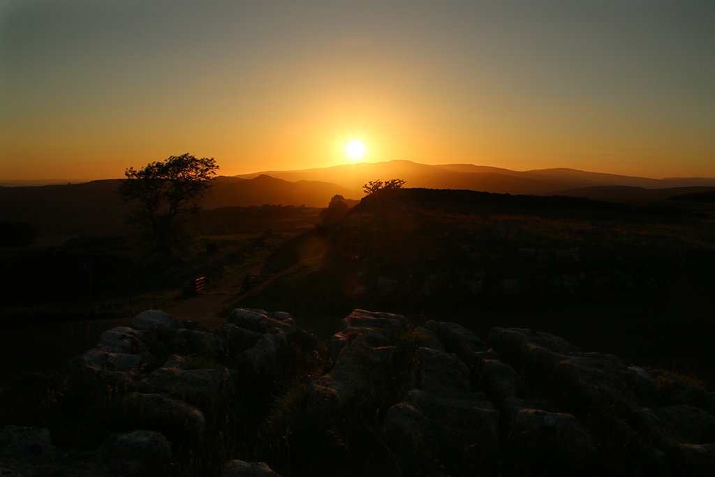
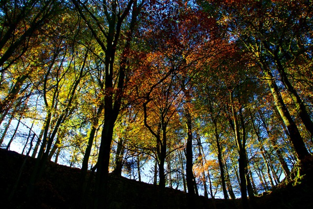
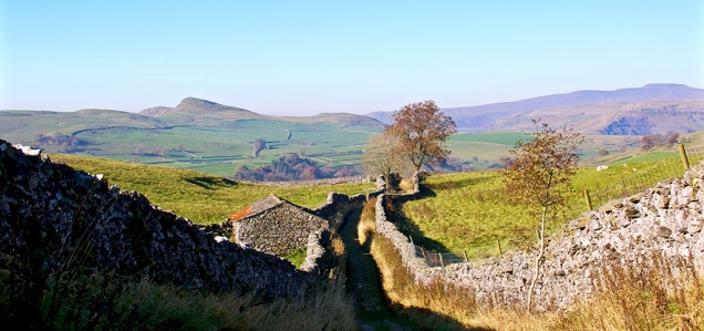
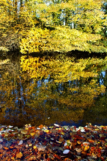
I hadn’t much chance to get out with the camera this week but here’s a medley of April photos showing how different the month can be. The first two pictures were taken during ‘this week’ a year apart. (Top near Moughton Scar, the other showing Ingleborough.)

april
Warrendale Knotts (above) one evening this week, and Halton Gill (below) last week.

“The sun was warm but the wind was chill.
You know how it is with an April day.
When the sun is out and the wind is still,
You’re one month on in the middle of May.
But if you so much as dare to speak,
a cloud come over the sunlit arch,
And wind comes off a frozen peak,
And you’re two months back in the middle of March.”
– Robert Frost, 1926

april
Two evening scenes from Horton-in-Ribblesdale taken this week. That’s Penyghent in the background on the shot below.

Do I ever travel ‘abroad’ to take photos, you ask. Well yes, of course – I took these at one of my favourite places outside the Yorkshire Dales: the NE coast around Bamburgh and Lindisfarne. I love the Yorkshire coast too, but the vast skyscapes and the unspoilt Northumberland beaches with their dramatic castles and history take some beating.

So we go to the polls again next week, once more trying to convince ourselves that we live in a democracy; that the ‘will of the people’ will triumph; that our cross on a bit of paper will bring us nearer to the Utopia we crave. Will you vote for a political party, no matter who the candidate might be? Or vote for someone who is actually looking to care for your corner of the country? I’d like to see local council elections stripped of all political labelling and backing; and for council chambers to cease trying to be mini-Houses of Parliament where party policies and in-fighting become more important than actual local issues.

april
Typical Dales April: above, Penyghent from the road to Halton Gill from Stainforth in glorious sunshine last week; below, this week Whernside hidden by low cloud as a goods train passes over Ribblehead Viaduct.

April
April ewes, ears and awws.

A short haul for a long Dales view

dalesFor a hill whose summit is just under 1,200ft above sea level, Smearsett Scar offers the kind of 360 degree view of the Dales usually reserved for walkers venturing a thousand feet higher. All the Three Peaks, Fountains Fell, Pendle Hill, the Bowland Fells and much more are visible. On very clear days you can probably make out the west coast.

dales
Top picture shows views over Moughton Scar and Crummckdale towards Ingleborough. Above, the view south west over Pot Scar.
dales
Looking up Ribblesdale to Penyghent; below the view of Warrendale Knotts.

The intricate limestone pavement of Moughton Scar stands out, and the green valleys of Crummack, Wenning and Ribble look gentle and welcoming. This small Ribblesdale peak, part of a short limestone ridge including Pot Scar, provided me with my only real exercise this week. A friend tells me he once spent a wonderful, clear, summer’s night at the top – it certainly wasn’t during this year’s brief summer.

dales
Smearsett Scar seen from the back road between Helwith Bridge and Stainforth. Below, gulls enjoying refreshments in fields below the scar.

More Dales churches

As I trundle around the Dales I often stop off to photograph local churches. I’m not a religious person but enjoy church architecture and history. And during several decades of delving into my family’s past I’ve spent many an hour tramping through graveyards looking for clues.
This week I briefly crossed into Lancashire from the western Dales to visit St Peter’s at Leck, where there’s been a church since the early 1600s.

Today’s building (above) is a relatively modern affair, having been rebuilt in 1913 following a fire, but it is still a grand sight in this quiet backwater off the main road to and from the Lakes. Leck Fell and nearby Gragareth are two hills I’ve never ascended but I seem to recall potholing trips around the area as a more adventurous youth.


Just a couple of miles away, switching from the Diocese of Blackburn to that of Leeds – both sounding incongruous for this part of the country – is St Oswald’s at Thornton-in-Lonsdale. Like at Leck’s church (and dozens more around the North) it seems to have links with the Brontes. There’s been a church here since pre-Norman times, but also similarly to St Peter’s it was gutted by fire (in 1933). The church was rebuilt in a Gothic style and looks splendid set in a well-kept churchyard. Sitting here I imagined this (and the neighbouring pub of course) being welcome sanctuary for those who travelled the lonely high pass from Dent through Kingsdale.

Not moonshine


I didn’t manage to snatch a shot of the Harvest Moon – we’ve had some cloudy nights in our part of the Dales this week – but I did capture some lovely evening sunlight around Ribblesdale.

Going off the grid in chuffing Ribblesdale

RibblesdaleYou’ll not find the name Beacon Scar on a modern OS map of Ribblesdale despite the place being higher and more significant than many of the surrounding named hills. Go back to the 1800s when they were fond of lighting beacons and you’ll find the hill on maps, 1,426ft above sea level beside Warrendale Knotts on the edge of Stockdale near Settle. Presumably the good folk at Ordnance Survey thought there were too many ‘Beacons’ around the north so they decided to cull a few.

RibblesdaleThey did however note that it was in such a strategic position that they placed a trig point where the ancient beacon would have been. If you stand there, looking west, you’ll note you are lined up almost in a straight line across Ribblesdale with Smearsett Scar and Ingleborough (see pic above) which also have trig points and were once beacon sites – and ideal places for warning locals of invading Scots in days gone by. The 360-degree view from Beacon Hill is superb. There’s a short video of it here if you’re interested. https://youtu.be/kQQwk7PebPM It wasn’t the clearest of days when I went up there on Monday and you’ll note the furthest fells are melting away a little.

Ribblesdale
Looking south from Beacon Scar across Stockdale toward Rye Loaf Hill.
Ribblesdale
Zoomed-in views of Penyghent and Ingleborough across Ribblesdale.


I’ve bumped into a lot of chuffing train enthusiasts on my saunters around Ribblesdale this week, as there’s been a lot of steam action on the Settle-Carlisle line. Here are a few of the shots I’ve taken:

Ribblesdale
Above, Flying Scotsman on a wet day near Helwith Bridge; below, yesterday passing through Settle and Giggleswick.

I see Tan Hill pub is for sale at £900k. When it was up for grabs in 2008 it was on the market for £1.1m although I don’t know what it eventually sold for. Pictures show the place some 50 years apart.

If you haven’t yet tried Ribblesdale’s newest Coffee House at The Folly in Settle then I can highly recommend it (they also do tea for tea freaks like me). https://www.facebook.com/follycoffeehouse/?rc=p Mind you, all the cafes and pubs in Settle are worth a visit – but don’t attempt to do them all in a day, you’ll put on two stone such is the quality of available cakes. Some of the creations for this year’s Flowerpot Festival are also impressive – another reason to visit the town. I hope to bring photos of the festival next week.

Away from the madding crowd in Ribblesdale

Yesterday I managed to squeeze in a stroll around one of my favourite spots, Thorns Gill and the derelict settlement of Thorns at the head of Ribblesdale. Ribblehead, looking more like Blackpool prom on a Bank Holiday Monday, is nobbut half a mile away yet there I was completely alone for an hour in this beautiful glen with its waterfalls and fascinating rock formations.

Sheep don’t often pose for me but I think this one’s a bit of a diva …

And finally…

A neighbouring cat gives me the eye for disturbing the peace. I wonder if cats dream in black and white?

During the week I also post shots and opinions on Twitter. Visit @paulinribb


Why life’s just hell in the Dales (12 pics)

My old milk-bottle legs got an airing in the sunny Dales yesterday. Shorts were donned for a walk around Warrendale Knotts just up the hill from home in Langcliffe. From the top of any of the limestone knolls you can enjoy great views east and west. The mighty scars here are as impressive as any along the Craven Fault, and the limestone Dales landscape contrasts greatly from the neighbouring gritstone area where Black Hill and Rye Loaf Hill loom darkly. In the west, Ingleborough and Penyghent look down on Ribblesdale. Top photo shows Attermire Scar with Black Hill and Rye Loaf Hill in the background.

Dales
View from Warrendale Knotts towards Victoria Cave and Penyghent
Off to Hell
Dales
Hellgill Force in the Yorkshire Dales National Park


Earlier in the week I drove through the Dales to the Mallerstang area, captured a steam train crossing Dandry Mire viaduct and took a trip to Hell. Well, Hellgill Force, to be precise. Sometimes this waterfall can be nobbut a trickle while other times it’s a truly spectacular sight when water cascades down from the steep fells. Hell Gill forms the boundary between Yorkshire and Westmorland and is where the water chooses which way to head to the coast – either west along the Lune and Eden route, or east and on to the North Sea via the Ure. This ‘Hell’ has nothing to do with that devil chap, in case you were wondering – the name stems from an Old Norse word ‘hella’, meaning flat stone.

Dales
The grass seemed greener than green along Silverdale road between Stainforth and Halton Gill – the colour is just down to the reflection of the sun.

dales
Robin Procter Scar and Foxgloves down a shady lane at Wharfe near Austwick on Saturday.

dales
A quiet moment in the Dales sunshine in Langcliffe
dales
End of a perfect week – sunset over Ingleborough seen from Winskill, Ribblesdale

Water way to go, cats, dogs and a dodgy chopper

ribweir

The value of natural flood plains in the Dales was highlighted this week as they calmed the flow of rivers swollen by the excessive rain. New lakes were created here in Ribblesdale and throughout the region, saving communities further down the valleys from severe flooding (apart from where housing and industrial development has been erroneously allowed). As well as poor planning decisions there are other problems along riverbanks which have been created by humans. One is the way some landowners have banked up river edges to preserve or increase grazing land. In times of flood these act as barriers, and instead of letting rivers spread naturally, they speed up flow causing problems elsewhere. Weirs, built in many cases to help power old mills and create mill ponds, can also have an adverse effect. I watched the weirs and Langcliffe and Settle this week and saw first hand what they do when the rivers are high and fast-flowing. These artificial barriers raise water levels behind then cause a huge hydraulic jump afterwards. This causes great turbulence and danger in the worst conditions as witnessed in my picture. I’m all for capturing a river’s power to create electricity through well-placed turbines but I wonder if weirs are really necessary today? Also, in low water weirs are a barrier to fish migration and promote the growth of algae.
dogturd

There’s a popular walk from Settle along Watery Lane, but it proved a bit too watery last Sunday. I did manage this photo, however, where it seems the local allotment holders or perhaps fellow walkers are fed up with coming across doggie-do. I’m not sure whether the luminous paint looks worse than the dog mess but it certainly gets the message across.
inglequarry

There was still plenty of water at the top of the dale on Monday as I took a stroll in the Ribblehead region and around Ingleborough Nature Reserve. Signs of industry don’t have to be depressing and can create some interesting views.

kilningle

whernquarry

While I was below  Ingleborough I came across the Coastguard Sikorsky S-92 helicopter which had got into difficulties the previous day. The Cave Rescue Organisation, based in Clapham, requested help from the Coastguard when they were called out to a walker suffering chest pains on Ingleborough. However, the chopper developed a fault and the rescue team had to help stop the multi-million pound contraption from toppling over. The human casualty was stretchered off the hill and taken by Landrover then ambulance to hospital. It took a further three days to rescue the rescue machine.
rescue

My cat knows that when I get the map out its food supplier is planning to leave the house and also turn off the heating, so he does his best at sabotage.
catmap

I was only away an couple of hours though, dropping over the Newby Head into Widdale and Wensleydale to visit the bonnie Cotter Falls. Great Knoutberry also looked grand from this angle.
cotterf

gtknout

The temperature dropped dramatically on Friday, especially on the moors above Malham. I’d planned to walk through the dry valley of Watlowes (pictured below) over to Malham Tarn but the wind was fierce and the conditions, well, nithering.
watlowetop

The drive back from Kirkby Malham to Settle was strange – on one side, looking towards Pendle, the change from cloud to sun was amazing; inspirational skies for the artists among us.

inspire

On the other side, as seen here with Ingleborough in the background and Warrendale Knotts in the foreground, was clear in bright blue sky.

ingwarren

Then the snow came yesterday so I headed back up Ribblesdale to do the Three Peaks (through photography from the car – I’m not that daft). The road up to Whernside was still pretty dodgy in the morning, especially where the sun hadn’t hit the road. The car told me the temperature was -1, goodness knows what it was like on top of those hills with the wind-chill.

whites

Falls, falling, fells and the fallen

DSC_0077.JPG

There’s a splendid website which I regularly visit called grough.co.uk which offers all sorts of news and views for walkers, visitors and residents of the Dales, Lakes and beyond. I read a report on there on Tuesday of a walker being rescued from Watlowes dry valley above Malham (pictured). The Clapham-based Cave Rescue Organisation came to the walker’s aid. It was the team’s 72nd rescue of the year. What a great job done by them and the other volunteer rescue teams, such as uwfra.org.uk.
catfallsuprightIt is so easy at this time of year to slip and slide on the fells. I nearly came a cropper myself, slipping on damp limestone while heading down the steep bank to Catrigg Force on Monday. All I was bothered about was my camera. We both emerged unscathed. I got a few photos of the water falls but I’ve not yet captured my ideal shot of this place. There’s usually a lot of ‘clutter’ in the way, but with leaves now dropping rapidly more can be seen of the main falls. Also, there’s such a contrast between the bottom half and the top half of the scene that getting the exposure right is difficult. Perhaps some experts can advise.

The bright blue sky seen through the canopy at Catrigg was almost the last I saw of it this week.

treescatrigg

The track up from Stainforth to Catrigg and on to Winskill seems to get steeper every time I tackle it but the view back down between the walls, looking over to Smearsett Scar and Ingleborough, provides a perfect excuse to stop.
stainlane

Tuesday’s stroll from Langcliffe to Settle via Victoria Cave and Warrendale Knotts was a strange affair. I moved from bright sunshine into thick fog several times. It’s a good job I know the route well – it would have been so easy to have strayed off course. Here’s one of the bright moments:

warrenmist

The landscape’s outline along this part of Stockdale sometimes reminds me of the wild west as seen in old cowboy films. So I couldn’t believe it when I saw heading towards me a herd of cattle being driven down from the hills by some farmhands. Ye-ah.

cattledrive

I chap momentarily mistook me for Mike Harding in Settle the other day; on top of this, someone else mentioned our similarities on Twitter. I wouldn’t mind but he’s even shorter than me and is also about 10 years older.  Either I’m looking older than my age or he appears youthful… let’s go with the latter. Perhaps I can get away with a few free pints around Settle? As long as they don’t ask me to sing Rochdale Cowboy or play the banjo. If you’re a fan of folk and traditional music I highly recommend Mike’s podcast which can be downloaded (for nowt) from mikehardingfolkshow.com every Sunday. Perhaps you can listen to it while reading this blog and imagine we’re the same person.
pondleaves
Even though I am ancient I still enjoy kicking my way through the fallen leaves as I’m walking down country lanes. The leaves offer an opportunity for some creative work with the camera – not that it’s my normal style, but I liked the colours and patterns of this shot across Langcliffe Mill Pond taken last Sunday.

Unfortunately, another engagement means I miss the Remembrance service at the village memorial today when the names of Langcliffe’s fallen are read out.

poppybw

%d bloggers like this: