 There’s a fabulous 360-degree Dales view from Stone Rigg at the head of Barbondale. If ever you want to know why more parts of this area have been roped into the revised Yorkshire Dales National Park then this is the place to go. Standing on the small rocky outcrops at the top of Stone Rigg – just a short walk from the steep, narrow road from Dent – you see the Howgills to the north. The lower end of the Howgill range is already in the park but further north towards Ravenstonedale is rightly being included later this year. Swinging right you stare across at Aye Gill Pike and down Dentdale to Great Knoutberry, then on to the western slopes of Great Coum and Crag Fell.


At 180 degrees you’re looking down Barbondale itself with the steep side of Middleton Fell glaring down on your right. I’ve been here several times before and never tire of the all-round beauty. Further down the narrow dale heading towards Barbon is a little boundary stone which signals the end of the current park. The lower slopes of the dale become thickly wooded before it opens out to reveal some glorious views along Lunesdale.
Later in the week I also revisited another part of the new park, heading up Mallerstang and stopping off at the enigmatic 12th-century Pendragon Castle. The view down towards Wild Boar Fell was, as always, a pleasure to see.
 From the castle it was on towards Nateby. Gypsies were camped ready for the final part of their annual journey to Appleby – it seemed an appropriate spot for their camp and surely much more of a pleasure for the horses than beside the busy A65 (where they’ve been causing enormous traffic jams). I love the journey between Nateby and Keld through Birkdale. Here is a very different Dales character to my normal Ribblesdale habitat: bleak and rough; fewer walls and tougher sheep. But you’re soon into a greener Upper Swaledale; enclosed by steep sides but gentler, with the young Swale dancing over exposed browned bedrock. A grand drive over Buttertubs Pass to Wensleydale, up Widdale and home via Three Peaks country of Ribblesdale. I might not be exercising my legs much at the moment but my eyes are certainly active.

I wonder, had Kirby Misperton fallen within their land, if the Dales National Park would have allowed last week’s fracking fiasco to happen? Seven councillors who are supposed to represent Yorkshire on matters of planning, ignored the 92 per cent of locals and instead pandered to what the government wanted them to do – a government which is currently keeping secret a report on whether fracking causes climate concern. Hell, even Lancastrian councillors had the sense to boot out the get-rich-quick fracking cowboys. Hang your heads, seven shameless Yorkshiremen.
Which brings me on to another whinge I have, stirred up by this week’s ‘news’. There’s a decline, says a study, in the humber of people using regional accents. It seems we are all starting to sound like we come from the south east. That certainly won’t do. And some teachers have been told to change the way they speak to children by cutting down on local accents. Sometimes I listen to people in their late teens/early 20s, using that very boring generic university accent, in which almost every sentence seems to end with a question mark, and I thank mi Mam n Dad for teaching me to speyk Yorksher.
Talking of moaning – an acquaintance was moaning about pot-holes in Ribblesdale’s roads the other week. This week he is moaning that ‘they’ are closing the roads throughout the region to mend those potholes. Now I’m moaning about him moaning.
Bridge of Sighs
 I was very saddened to see that someone had a go at demolishing the pretty packhorse bridge over the Ribble at Knight Stainforth this week. Obviously, the person didn’t go out to deliberately wreck the ancient structure – whether it was caused by someone using a sat nav instead of a brain cell, or by careless driving, I don’t know. But it’s going to be costly to repair the National Trust-owned bridge. The original stonework is going to have to be recovered from the river before it is washed away, and the bridge will probably not look the same when rebuilt. It wasn’t meant to take motorised traffic. I realise this will inconvenience a few local users but I think the current diversion via Stackhouse Lane or Helwith Bridge should be made permanent and the bridge left for cyclists and pedestrians only. I’m keeping my fingers crossed that during the Bank Holiday weekend, which brings all kinds of folk to Stainforth Foss, we don’t see more damage or accidents.

Better Dales news
After all that misery I should finish on some high notes. The British Mountaineering Council, through its Mend our Mountains campaign has raised more than £12,000 for the Yorkshire Dales National Park authority project to help improve footpaths on Ingleborough. More details here
http://www.yorkshiredales.org.uk/living-and-working/how-we-can-help/press-office/news/recent/crowdfunding-boost-for-three-peaks
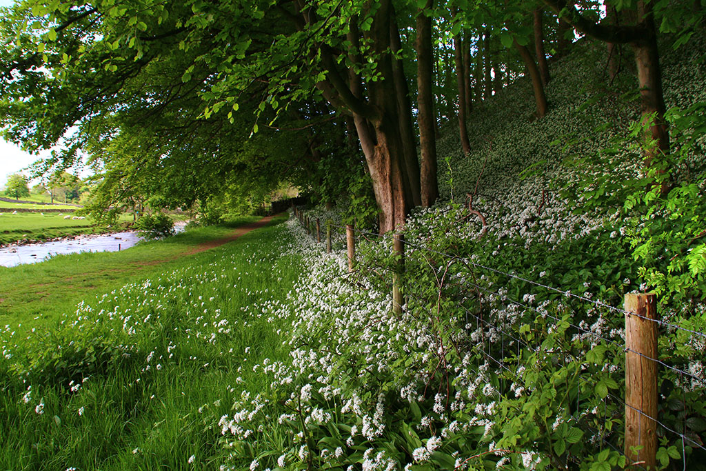 It’s been a pleasure hobbling around Ribblesdale this week while spring really blossomed. By the Ribble in Langcliffe were thousands of rampant ramsons like riotious football fans charging down the packed terrace, hopping over the fencing and spilling on to the pitch.

 Sitting here listening to the birds and a gently trickling river was simply beautiful. However, one youngster licking its lips as it approached me was a little disconcerting…


